

What is the location of Mount Everest?
The world’s tallest mountain, Mount Everest (8,848m), is a testament to human ambition and a symbol of the majesty of nature. Everest, the world’s highest mountain, attracts climbers, explorers, and environment lovers from all over the world. The goal of this blog is to educate and acquaint you with Everest.
Different Names for Mount Everest
e Nepali name for Everest, is derived from Sanskrit. Sagarmatha means the head of the sky since “sagar” means sky and “matha” means “head.” Sagarmatha is also referred to as the “goddess of the sky.” We were unable to verify that Sagarmatha indeed means “divine of the sky,” nevertheless.
This name draws attention to the mountain’s imposing and magnificent appearance, which dominates the skyline and represents the bond between the earth and the heavens. For the Nepali people, Sagarmatha is not only a geographical landmark but also a symbol of their culture and religion.
The mountain is most generally referred to in the West as Mount Everest, after Sir George Everest, who served as the British Surveyor General of India from 1830 to 1843. Even though Sir Everest himself had never seen the summit, Andrew Waugh, Everest’s successor, suggested the moniker. During the 19th century, this name was a part of the British endeavor to map and record the geographical features of the Indian subcontinent.
Chomolungma, the Tibetan name for Everest, translates to “Mother of the Universe” or “Goddess Mother of the World.” For the Tibetan people, who view the mountain as a divine entity and a representation of great strength and endurance, this name emphasizes the mountain’s sacred significance. Similar to its Nepali equivalent, the Tibetan name expresses strong spiritual and cultural ties to the mountain.
Geographic Reach and Development
One of the most magnificent and important mountain ranges in the world, the Himalayas cover five nations: China (Tibet), India, Nepal, Bhutan, and Pakistan. The Himalayas are frequently referred to as the “Roof of the World” because of their magnificent scenery, high peaks, and deep cultural significance.
The Himalayas, which constitute a huge barrier between the Tibetan Plateau and the Indian subcontinent, span more than 2,400 kilometers (1,500 miles) from west to east, including Everest.
The Indian subcontinent and the Tibetan plateau are divided by the Himalayas. According to geologists, the Himalayas were formed millions of years ago.
According to scientists, all of Earth’s land was part of a supercontinent known as Pangaea 225 million years ago. India used to be a large island in Pangea, close to Australia, with the Tethys Ocean separating it from Asia. About 200 million years ago, as Pangaea began to fragment, India started to move northward toward Asia.
India was still moving toward Asia at a rate of 9 to 16 centimeters per year about 80 million years ago. Around 40 million years ago, when the Indian and Eurasian plates collided, this movement slowed to 6 cm annually.
The majority of Europe and Asia are part of the Eurasian Plate, one of the planet’s main tectonic plates. It stretches from the Pacific Plate’s edge in the east to the Atlantic Ocean in the west. The entirety of Europe, the majority of Asia (except from the Indian subcontinent, the Arabian Peninsula, and portions of eastern Russia), and the Arctic Ocean are among the prominent areas and landforms that are part of this enormous plate.
The Himalayas and the Tibetan Plateau were created when the Eurasian plate crumpled as a result of the Indian and Eurasian plates colliding. The Indian plate continues to move at a rate of 67 mm per year, which causes the Himalayas to rise by roughly 5 mm per year and increases the likelihood of earthquakes in the area.
Trekkers, climbers, and outdoor enthusiasts are drawn to the Himalayas, which serve as a global center for adventure tourism. The Annapurna Circuit, the Markha Valley trip, and the Everest Base Camp climb are all well-liked hiking routes. Another big lure is mountaineering, since climbers face difficult obstacles on Everest and other high peaks.
According to geologists, the continuous tectonic action between the Indian and Eurasian plates is the reason why Mount Everest grows by about 4 millimeters annually. The dynamic character of the Earth’s crust and the unrelenting geological processes at work are demonstrated by its slow increase.
Numerous national parks and protected places that maintain the Himalayas’ biodiversity and natural beauty include:
- The Everest region is part of Nepal’s Sagarmatha National Park, a UNESCO World Heritage Site.
- India’s Great Himalayan National Park is renowned for its breathtaking scenery and abundant wildlife in Himachal Pradesh.
- Bhutan’s second-largest protected area is Jigme Dorji National Park.
The Himalayas’ Cultural and Ecological Significance
The Himalayas are a cultural and ecological gem in addition to being a geographical wonder. From alpine meadows with permanent ice and snow at higher elevations to subtropical woods at lower elevations, the range is home to a variety of ecosystems. Numerous plant and animal species, including endangered ones like the snow leopard, red panda, and Himalayan blue sheep, are supported by this diversity.
In terms of culture, the Himalayas are extremely important to many different people and religions. Numerous monasteries, temples, and pilgrimage sites can be found in the area, such as the Tengboche Monastery in Nepal, which is a significant spiritual hub for Tibetan Buddhism; Kedarnath and Badrinath in India, which are significant Hindu pilgrimage sites; and Paro Taktsang in Bhutan, also known as the Tiger’s Nest Monastery, which is a revered Vajrayana Himalayan Buddhist site for Bhutanese Buddhists.
More than one-fifth of the world’s population depends on the Himalaya-Tibet region for their fresh water, underscoring its significance.
Everest’s designation as the highest peak
The Great Trigonometrical Survey of India formally acknowledged Mount Everest as the highest peak in the world in 1856. The original estimate of the mountain’s height was 29,002 feet (8,839 meters). The discovery that Everest was the highest peak captivated the interest of both scientists and explorers.
Between 1952 and 1954, the study of India conducted another study and determined another value: 8,847.73 m (29,028 ft). The height was then measured by a Chinese team in 1975 and found to be 8,848.13 meters (29,029.30 feet). The height of Everest is 8,848.86 meters (29,031 feet 8.5 inches), according to the most current survey conducted in 2020 by a joint team from China and Nepal.
The First Ascent
The British mountaineers were the first to try Everest, according to recorded history. The British attempted to ascend Everest via the north ridge route from the Tibetan side after the Nepali authorities forbade them from entering the country due to suspicions about their motives. The first time a human had climbed above 8,000 meters was in 1922, when the British used the north Col and reached 8,320 meters.
Although Gorge Mallory and Andrew Irvin were spotted on their way to the summit on June 8, 1924, there is no proof that they were successful.
However, Tenzing Norgay Sherpa of Nepal and Edmund Hillary of New Zealand used the southeast ridge to achieve the first summit accomplishment that was documented and confirmed in 1953.
Ways to Reach Everest
The majority of tourists take flights to Lukla, a tiny hamlet in the Khumbu region, in order to access Everest. However, because of traffic at Kathmandu’s Tribhuvan International Airport, flights to Lukla are frequently redirected from Manthali Airport near Ramechhap during the busiest trekking seasons of spring (March, April, and May) and fall (September, October, and November).
You must depart Kathmandu at around 1 AM in order to make the five-hour drive to Manthali Airport in time for a morning flight from Manthali to Lukla. Because Lukla’s afternoon winds make landing planes challenging, you have to take an early morning flight.
You may take a direct flight from Kathmandu to Lukla at off-peak times. Most hikers go to Namche Bazaar, a busy Sherpa settlement that is the entry point to Everest, after arriving in Lukla. There are multiple ways to Everest Base Camp from Namche Bazaar, including ones that pass through the Gokyo region.
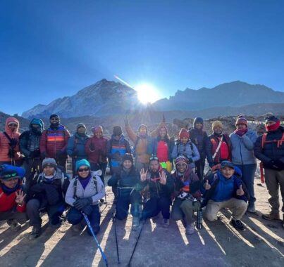
The most well-liked trek, the traditional walk to Everest Base Camp, lasts roughly 14 days and provides a more thorough view of the breathtaking Himalayan scenery.
You have the option of taking a one-day helicopter excursion to Everest Base Camp if you are pressed for time.
Communities Near Everest
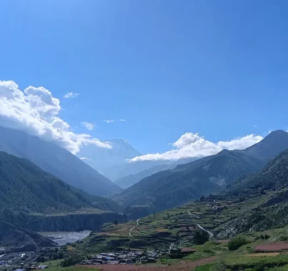
There are many Sherpa communities in the area surrounding Everest, the most prominent of which is Namche Bazaar, the entry point to the high Himalayas. With marketplaces, teahouses, pubs, motels, cafes, and lodges that serve hikers and climbers, Namche is a thriving town. Other notable communities are Dingboche, a well-liked acclimatization stop, and Tengboche, which is renowned for its exquisite monastery.
Gorak Shep is the closest community to the Everest Base Camp. In order to witness the breathtaking sunrise from Kala Pathhar Viewpoint, the majority of hikers who make the journey to the Everest Base Camp spend the night at Gorak Shep.
Sagarmatha National Park
Sagarmatha National Park, a 1,148 square kilometer UNESCO World Heritage Site, is home to Mount Everest. The park is well known for its distinctive biodiversity, which includes a variety of plants and animals that have adapted to the high altitude. This unspoiled area is home to a variety of bird species, snow leopards, red pandas, and Himalayan tahrs.
Mountains in the area
Everest does not stand alone. The Everest region is home to several other towering peaks, each with its allure. Notable neighboring mountains near Everest include:
- Lhotse (8,516 meters): The fourth highest mountain in the world, closely linked with Everest
- Makalu (8,485 meters): The fifth-highest mountain in the world, known for its steep pitches and sharp edges
- Cho Oyu (8,188 meters): The sixth-highest mountain in the world, popular among climbers for its relatively moderate climbing routes compared to other peaks over 8,000 meters
- Nuptse (7,861 meters): Known for its impressive South Face, a prominent feature in many photographs of Everest
- Ama Dablam (6,812 meters): Often considered one of the most beautiful mountains in the world, renowned for its striking, pyramid-like shape
Conclusion
The height of both human achievement and natural awe is Mount Everest. A special fusion of adventure and scientific fascination is provided by its location, geological formation, and the trek to its base camp. The appeal of Everest and the surrounding Himalayas is irresistible, offering an amazing experience in one of the most breathtaking settings on earth, regardless of your level of skill as a climber or your level of enthusiasm for trekking.
We invite you to the Everest Base Camp Trek if you would want to see Mount Everest up close.
Table of Contents